Back Groot St. Bernardtonnel Afrikaans نفق سانت برنارد Arabic Grosser-St.-Bernhard-Tunnel German تونل گریت سنت برنارد Persian Sankt Bernhardin tunneli Finnish Tunnel du Grand-Saint-Bernard French Tunèl du Grant-Sent-Bèrnârd FRP Szent Bernát-alagút Hungarian Traforo del Gran San Bernardo Italian 그랑 생베르나르 터널 Korean
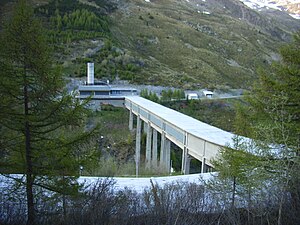
 Italian side of the tunnel | |
| Overview | |
|---|---|
| Other name(s) | Tunnel du Grand Saint-Bernard (French) Traforo del Gran San Bernardo (Italian) Grosser-Sankt-Bernhard-Tunnel (German) |
| Location | Italy/Switzerland |
| Coordinates | 45°51′52″N 7°10′22″E / 45.8645°N 7.17266°E |
| Status | Open |
| Route | |
| Crosses | Great St Bernard Pass |
| Start | |
| End | |
| Operation | |
| Work begun | 1958 |
| Opened | 19 March 1964 |
| Operator | SISEX S.A. |
| Traffic | Automotive |
| Toll | See list |
| Technical | |
| Length | 5,798 m (6,341 yd) |
| No. of lanes | 2 (one per direction) |
| Operating speed | 80km/h (50mph) |
| Highest elevation | 1,918 m (6,293 ft) |
| Lowest elevation | 1,875 m (6,152 ft) |
Location of the tunnel in Aosta Valley
Location of the tunnel in Valais
The Great St Bernard Tunnel (French: Tunnel du Grand Saint-Bernard, Italian: Traforo del Gran San Bernardo, German: Grosser-Sankt-Bernhard-Tunnel) is a road tunnel complementing the Great St Bernard Pass, linking Martigny (in the Swiss canton of Valais) with Saint-Rhémy-en-Bosses (in the Aosta Valley, in north western Italy).

